Sinuiju
Sinŭiju (Korean pronunciation: [si.nɰi.dzu]); Sinŭiju-si, known before 1925 in English as Yeng Byen City[2][3]) is a city in North Korea which faces Dandong, China across the international border of the Yalu River. It is the capital of North P'yŏngan province. Part of the city is included in the Sinŭiju Special Administrative Region, which was established in 2002 to experiment with introducing a market economy. In recent years, the city, despite lagging behind the development in the capital Pyongyang, has seen a small construction boom and increasing tourism from China.[4]
Sinŭiju
신의주시 | |
|---|---|
| transcription(s) | |
| • Chosŏn'gŭl | 신의주시 |
| • Hancha | 新義州市 |
| • Revised Romanization | Sinuiju-si |
| • McCune-Reischauer | Sinŭiju-si |
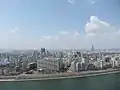
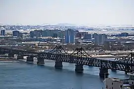 Aerial view of Downtown Sinŭiju, from Dandong, China | |
| Motto(s): The emblem Magnolia. | |
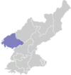
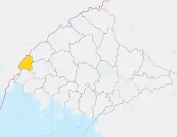 Map of North Pyongan showing the location of Sinŭiju | |
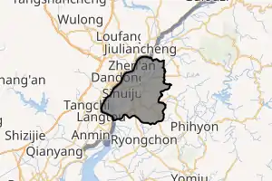 | |
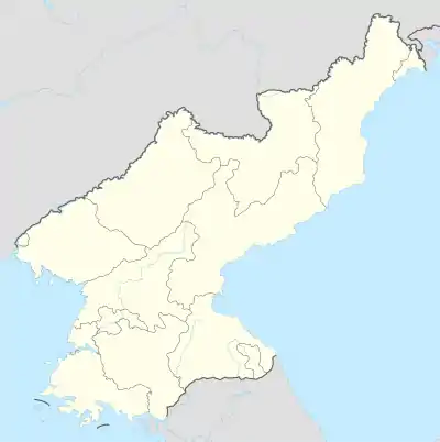  Sinŭiju Location within North Korea | |
| Coordinates: 40°06′N 124°24′E | |
| Country |  North Korea North Korea |
| Province | North P'yŏngan |
| Administrative divisions | 49 tong, 9 ri |
| Area | |
| • Total | 180 km2 (70 sq mi) |
| Population (2008) | |
| • Total | 359,341[1] |
| • Dialect | P'yŏngan |
| Time zone | UTC+9 (Pyongyang Time) |
Geography
.jpg.webp)

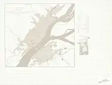
Sinŭiju is bordered by the Amnok River, and by P'ihyŏn and Ryongch'ŏn counties. The city's altitude is 1 metre (4 feet) above sea level. There are several islands at the mouth of the Amnok River - Wihwa-do, Rim-do, Ryuch'o-do and Tongryuch'o-do.
Administrative divisions
Sinuiju city is the heart of the Sinuiju Special Administrative Region. The city is currently divided into 49 tong (neighbourhoods) and 9 ri (villages):
| Name | Chosŏn'gŭl | Hancha |
|---|---|---|
| 5-1-dong (O-il-dong) | 5-1동 (오일동) | 五一洞 |
| Apkang-dong | 압강동 | 鴨江洞 |
| Chaeha-dong | 채하동 | 彩霞洞 |
| Chinseon 1-dong | 친선1동 | 親善一洞 |
| Chinseon 2-dong | 친선2동 | 親善二洞 |
| Cheongsong-dong | 청송동 | 靑松洞 |
| Haebang-dong | 해방동 | 解放洞 |
| Kaehyeok-dong | 개혁동 | 改革洞 |
| Koseong-dong | 고성동 | 古城洞 |
| Keunhwa-dong | 근화동 | 芹花洞 |
| Majeon-dong | 마전동 | 麻田洞 |
| Minpho-dong | 민포동 | 敏浦洞 |
| Namha-dong | 남하동 | 南下洞 |
| Namjung-dong | 남중동 | 南中洞 |
| Nammin-dong | 남민동 | 南敏洞 |
| Namsang-dong | 남상동 | 南上洞 |
| Namseo-dong | 남서동 | 南西洞 |
| Namsong-dong | 남송동 | 南松洞 |
| Baekun-dong | 백운동 | 白雲洞 |
| Baeksa-dong | 백사동 | 白沙洞 |
| Baekto-dong | 백토동 | 白土洞 |
| Bangjik-tong | 방직동 | 紡織洞 |
| Bonbu-dong | 본부동 | 本部洞 |
| Panmun-dong | 판문동 | 板門洞 |
| Pungseo 1-dong | 풍서1동 | 豊西一洞 |
| Pungseo 2-dong | 풍서2동 | 豊西二洞 |
| Pyeonghwa-dong | 평화동 | 平和洞 |
| Ragwon 1-dong | 락원1동 | 樂園一洞 |
| Ragwon 2-dong | 락원2동 | 樂園二洞 |
| Rakcheong 1-dong | 락청1동 | 樂清一洞 |
| Rakcheong 2-dong | 락청2동 | 樂清二洞 |
| Ryeonsang 1-dong | 련상1동 | 蓮上一洞 |
| Ryeonsang 2-dong | 련상2동 | 蓮上二洞 |
| Ryusang 1-dong | 류상1동 | 柳上一洞 |
| Ryusang 2-dong | 류상2동 | 柳上二洞 |
| Sinnam-dong | 신남동 | 新南洞 |
| Sinpo-dong | 신포동 | 新浦洞 |
| Sinwon-dong | 신원동 | 新元洞 |
| Seokha 1-dong | 석하1동 | 石下一洞 |
| Seokha 2-dong | 석하2동 | 石下二洞 |
| Songhan-dong | 송한동 | 送鷴洞 |
| Seonsang-dong | 선상동 | 仙上洞 |
| Sumun-dong | 수문동 | 水門洞 |
| Dongha-dong | 동하동 | 東下洞 |
| Dongjung-dong | 동중동 | 東中洞 |
| Dongsang-dong | 동상동 | 東上洞 |
| Wai-dong | 와이동 | 瓦耳洞 |
| Yeokcheon-dong | 역전동 | 驛前洞 |
| Yeonha-dong | 연하동 | 煙下洞 |
| Jungjae-ri | 중재리 | 中斉里 |
| Hadan-ri | 하단리 | 下端里 |
| Ryucho-ri | 류초리 | 柳草里 |
| Samgyo-ri | 삼교리 | 三橋里 |
| Samryong-ri | 삼룡리 | 三龍里 |
| Sangdan-ri | 상단리 | 上端里 |
| Seongseo-ri | 성서리 | 城西里 |
| Daji-ri | 다지리 | 多智里 |
| Toseong-ri | 토성리 | 土城里 |
History
Developed as a major settlement during the colonial rule at the terminus of a railway bridge across the Amrok River, Sinuiju is located 11 km (7 miles) south by southwest of Ŭiju, the old city from whose name Sinŭiju (meaning “New Ŭiju”) derives. As an open port, it grew commercially with the logging industry which uses the Amnok River to transport lumber. Additionally, a chemical industry developed after the hydroelectric Sup'ung Dam was built further up the river.
In the course of the Korean War, after being driven from P'yŏngyang, Kim Il Sung and his government temporarily moved its capital to Sinŭiju[5][6] - although as UNC forces approached, the government again moved - this time to Kanggye.[6] Also, the city sustained heavy damage from aerial bombardment as part of the United States Air Force's strategic bombing of North Korea; 95 percent of the city was destroyed.[7] However, the city has since been rebuilt.
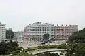
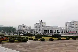
In 2018, a master plan for the redevelopment of the city was unveiled and shown to Kim Jong-un, which would have featured many high rise buildings and parks, centered around the road leading to the statues of Kim Il Sung and Kim Jong Il. Ultimately, this plan has yet to be fulfilled, with the only major work completed being the repaving of roads leading to the statues and the red coloured, circular apartment building behind and the Sinuiju Youth Open Air Theatre's completion, although the industrial areas in the city have seen some reconstruction.[8]
Economy
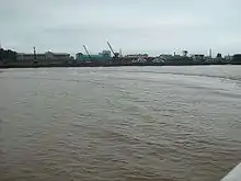
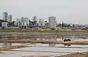
An important light industry centre in North Korea, Sinŭiju has a plant manufacturing enamelled ironware as well as a textile mill, paper mill and an afforestation factory. Its southwest harbour has a shipyard, although the shipyard's main function is seemingly to dismantle ships for scrap metal and other usable materials rather than building new ships. The area has recycling plants which recycle a wide range of material, including products that are banned for recycling in China.[9][10][11] The Sinŭiju Cosmetics Factory is located in South Sinŭiju (Namsinŭiju).
Trade with China
A substantial portion of North Korea's international trade, both legal and illegal, passes through Sinuiju and Dandong, across the Amnok River.[12]
Transportation
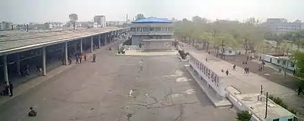
Sinŭiju can be reached from P'yŏngyang by air, railway and road. It can be reached from Dandong in China by crossing the Amnok River by bridge or boat. Foreign tourists on excursion boats from Dandong are sometimes permitted to approach within a few meters of the city's coastline, as long as they do not land.[14]
Air
Sinŭiju's airport has a single turf runway 03/21 measuring 991 metres by 61 metres (3250 feet by 213 feet).[15] Air Koryŏ operates passenger and cargo flights from P'yŏngyang.
Rail
Sinŭiju Ch'ŏngnyŏn Station is the northern terminus of the Korean State Railway's P'yŏngŭi Line from P'yŏngyang; the district is also served by several other stations on the P'yŏngŭi line, as well as the Tŏkhyŏn and Paengma lines. It is also connected with the Chinese city of Dandong in Liaoning Province (China) by the Sino-Korean Friendship Bridge, which is 944 m (3,097 ft) long from end to end, and through the Manchuria Railway links up with the Trans-Siberian railway. The factories of the city of Sinŭiju are provided with railway service via the Kang'an Line.
Urban transit
Sinuiju has a trolleybus line that runs from the city centre to the railway station. It was reopened in October 2020 with new trolleybuses derived from the Pyongyang Chollima-321 trolleybus. It formerly had another line running from the Sinuiju Chongnyon Station to Ragwon Machine Complex that closed between 2005 and 2009 with the reconstruction of the highway with a shifted alignment.[16]
Climate
Sinŭiju has a monsoonal humid continental climate (Köppen Dwa) with hot, humid and stormy summers and cold, dry winters with little snowfall.
| Climate data for Sinuiju (1991–2020, extremes 1957–present) | |||||||||||||
|---|---|---|---|---|---|---|---|---|---|---|---|---|---|
| Month | Jan | Feb | Mar | Apr | May | Jun | Jul | Aug | Sep | Oct | Nov | Dec | Year |
| Record high °C (°F) | 9.2 (48.6) |
15.5 (59.9) |
22.0 (71.6) |
28.4 (83.1) |
32.0 (89.6) |
37.0 (98.6) |
36.9 (98.4) |
37.1 (98.8) |
33.0 (91.4) |
28.9 (84.0) |
21.5 (70.7) |
13.9 (57.0) |
37.1 (98.8) |
| Average high °C (°F) | −0.8 (30.6) |
2.9 (37.2) |
8.8 (47.8) |
16.1 (61.0) |
22.0 (71.6) |
25.9 (78.6) |
28.3 (82.9) |
29.2 (84.6) |
25.6 (78.1) |
18.3 (64.9) |
8.7 (47.7) |
0.5 (32.9) |
15.5 (59.9) |
| Daily mean °C (°F) | −6.2 (20.8) |
−2.8 (27.0) |
3.2 (37.8) |
10.1 (50.2) |
16.2 (61.2) |
20.9 (69.6) |
24.1 (75.4) |
24.5 (76.1) |
19.7 (67.5) |
12.2 (54.0) |
3.6 (38.5) |
−4.2 (24.4) |
10.1 (50.2) |
| Average low °C (°F) | −10.3 (13.5) |
−7.2 (19.0) |
−1.2 (29.8) |
5.4 (41.7) |
11.5 (52.7) |
17.0 (62.6) |
21.2 (70.2) |
21.1 (70.0) |
15.1 (59.2) |
7.5 (45.5) |
−0.4 (31.3) |
−8.0 (17.6) |
6.0 (42.8) |
| Record low °C (°F) | −25.0 (−13.0) |
−26.0 (−14.8) |
−18.9 (−2.0) |
−5.0 (23.0) |
−2.6 (27.3) |
3.0 (37.4) |
10.7 (51.3) |
10.0 (50.0) |
2.8 (37.0) |
−5.3 (22.5) |
−15.0 (5.0) |
−22.8 (−9.0) |
−26.0 (−14.8) |
| Average precipitation mm (inches) | 5.9 (0.23) |
14.9 (0.59) |
20.3 (0.80) |
53.7 (2.11) |
85.0 (3.35) |
122.6 (4.83) |
251.9 (9.92) |
241.3 (9.50) |
95.7 (3.77) |
78.8 (3.10) |
37.2 (1.46) |
13.6 (0.54) |
1,020.9 (40.19) |
| Average precipitation days (≥ 0.1 mm) | 2.1 | 3.2 | 3.8 | 6.4 | 7.7 | 9.8 | 12.6 | 10.4 | 5.7 | 5.6 | 5.2 | 4.0 | 76.5 |
| Average snowy days | 3.5 | 3.1 | 2.1 | 0.3 | 0.1 | 0.0 | 0.0 | 0.0 | 0.0 | 0.1 | 1.9 | 4.4 | 15.5 |
| Average relative humidity (%) | 60.2 | 59.9 | 61.8 | 63.7 | 70.0 | 78.0 | 84.2 | 81.7 | 73.7 | 68.0 | 65.6 | 62.5 | 69.1 |
| Mean monthly sunshine hours | 199 | 195 | 227 | 228 | 237 | 207 | 163 | 200 | 220 | 208 | 169 | 172 | 2,425 |
| Source 1: Korea Meteorological Administration[17] | |||||||||||||
| Source 2: Deutscher Wetterdienst (sun, 1961–1990),[18][19][lower-alpha 1] Meteo Climat (extremes)[20] | |||||||||||||
Places of interest
.jpg.webp)
Facilities in Sinŭiju include Sinŭiju High School, Sinŭiju Commercial High School, Eastern Middle School, Sinŭiju Light Industry University, Sinŭiju University of Medicine and the Sinuiju University of Education. Scenic sites include the Tonggun Pavilion, Waterfall, and Hot Springs.
There also is a Ferris wheel overlooking the Amnok River, reportedly broken.[21]
Notable people
- Sohn Kee-chung, South Korean Olympic athlete and long-distance runner
- Yi Sung-sun, South Korean street knight
- Yushoku Cho, Japanese speed skater
See also
Notes
- Station ID for Sinuiju is 47035 Use this station ID to locate the sunshine duration
References
- 북한통계>인구일제조사>2008년>인구>도, 시/구역/군, 도시/농촌별, 성별인구 통계청 북한통계, 2018년 10월 7일 확인.
- "Yeng-byen, North Pyongan Province, North Korea". www.mindat.org. Retrieved 2017-10-01.
- Minutes of the Korea Annual Conference. Seoul, South Korea: The Fukuin Printing Company. 1914. p. 27.
- "Sights of Sinuiju: Change and continuity in North Korea's window to China | NK News".
- Sandler, Stanley (1999). The Korean War: No Victors, No Vanquished. The University Press of Kentucky. p. 108.
- Mossman, Billy (June 29, 2005). United States Army in the Korean War: Ebb and Flow November 1950-July 1951. University Press of the Pacific. p. 51.
- Archived at Ghostarchive and the Wayback Machine: "Firebombing North Korea - The US and the Korean War". YouTube.
- "Sinuiju City: Big Plans, Little Progress | 38 North: Informed Analysis of North Korea". 38 North. 2021-03-08. Retrieved 2021-03-14.
- Rank, Michael (March 15, 2013). "North Korean-Taiwan nuclear waste deal thwarted over export permit". NK Economic Watch. Retrieved 19 March 2013.
- Rank, Michael (30 June 2008). "North Korea in bid to recycle toxic waste". The Telegraph. Archived from the original on 19 January 2010. Retrieved 19 March 2013.
- "Dalian-based Huatai Recycling Resources Co Ltd" (in Chinese). Retrieved 19 March 2013.
- Jane Perlez and Yufan Huang (March 31, 2016). "A Hole in North Korean Sanctions Big Enough for Coal, Oil and Used Pianos". The New York Times. Retrieved April 3, 2016.
China accounts for about 90 percent of North Korea’s trade. Half of that business is estimated to flow through Dandong...
- "Market expansion: Sinuiju". North Korea Economic Watch. 3 April 2013. Retrieved 9 April 2013.
- Cruddas, Sarah (2014-02-18). "Peering into North Korea : North Korea". BBC - Travel. Retrieved 2014-07-24.
- Landings database page "Landings.Com", accessed 06 Aug 2010,
- "Sinuiju". transphoto.org. Retrieved 2020-11-26.
- "30 years report of Meteorological Observations in North Korea (1991 ~ 2020)" (PDF) (in Korean). Korea Meteorological Administration. pp. 209, 291, and 344. Archived (PDF) from the original on 29 January 2022. Retrieved 23 March 2022.
- "Klimatafel von Sinuiju / Korea (Nordkorea)" (PDF). Baseline climate means (1961-1990) from stations all over the world (in German). Deutscher Wetterdienst. Retrieved 6 November 2016.
- "Station 47035 Sinuiju". Global station data 1961–1990—Sunshine Duration. Deutscher Wetterdienst. Archived from the original on 2017-10-17. Retrieved 6 November 2016.
- "Station Sinuiju" (in French). Meteo Climat. Retrieved 6 November 2016.
- Kane, Daniel (October 22, 2010). "Observations from Dandong". NK News. Retrieved December 18, 2016.
Further in shore I spotted Sinuiju’s signature monument, the Ferris wheel that doesn’t move.
Further reading
- Cathcart, Adam; Kraus, Charles (2008). "Peripheral Influence: The Sinŭiju Student Incident of 1945 and the Impact of Soviet Occupation in North Korea". Journal of Korean Studies. 13 (1): 1–28. doi:10.1353/jks.2008.0002. S2CID 144775147.
- Dormels, Rainer (2014). North Korea's Cities: Industrial facilities, internal structures and typification. Jimoondang. ISBN 978-89-6297-167-5.
External links
 |
Wikimedia Commons has media related to Sinuiju. |
 |
Wikivoyage has a travel guide for Sinuiju. |
- City profile of Sinuiju
- North Korea Uncovered, (North Korea Google Earth) see a mapping of Sinuiju's main infrastructure, power lines, railroad, detention center, and Kim Jong Il residence, plus a whole lot more.
| 2,000,000 and more |
|
|---|---|
| 1,000,000–1,999,999 |
|
| 500,000–999,999 | |
| 200,000–499,999 | |
Largest cities or towns in North Korea | |||||||||||||||||||||||||||||||||||||||||||||||||||||||||||||||||||||||||||||||||||||||||||||
|---|---|---|---|---|---|---|---|---|---|---|---|---|---|---|---|---|---|---|---|---|---|---|---|---|---|---|---|---|---|---|---|---|---|---|---|---|---|---|---|---|---|---|---|---|---|---|---|---|---|---|---|---|---|---|---|---|---|---|---|---|---|---|---|---|---|---|---|---|---|---|---|---|---|---|---|---|---|---|---|---|---|---|---|---|---|---|---|---|---|---|---|---|---|
| |||||||||||||||||||||||||||||||||||||||||||||||||||||||||||||||||||||||||||||||||||||||||||||